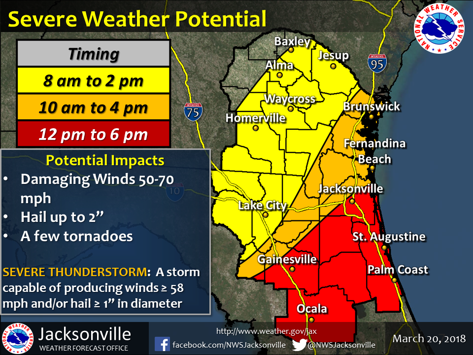
March 20, 2018 – The National Weather Service (NWS) says there is an enhanced risk of severe weather throughout North Central Florida today. The Santa Fe College Emergency Management team is monitoring all information that comes in from the NWS regarding the storm and advising college administration of all potential hazards.
Although the inclement weather can occur at any time, the NWS estimates the worst part of the storm could impact all SF properties between 10 a.m. – 4 p.m.
Isolated thunderstorms are expected to develop during the morning hours which have the potential for heavy rains and dangerously strong winds. Winds are expected to increase throughout the day to around 25 mph with gusts over 40 mph through the late afternoon/early evening hours.
Thunderstorm activity is expected it increase across the region as a cold front moves through. Thunderstorms may be strong to severe with more damaging winds, large hail and the possibility of tornadoes.
The threat of wind and rain will diminish into the evening and overnight hours.
At this point, SF remains open and has no immediate plans to change that status. All SF students, faculty and staff should take any precautions they feel necessary to ensure their safety.